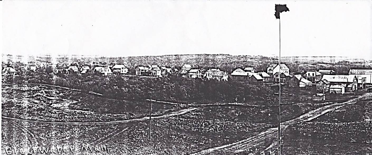
 Date ______ , CPR Napinka Sub. Mile 21. Clearwater from the S.W., view- looking N.E. Main track in the foreground (lower right), and possible sand spur in the centre of photo which was used by the CPR to fill in the ends of the trestle over Long River. (Information – “Prairie Pride Land-Looking Back” The Louise History Book Committee, 1998) (Click on photo for detail)
359 The Napinka Subdivision, Mile 0 to Mile 49.
Leave a reply
