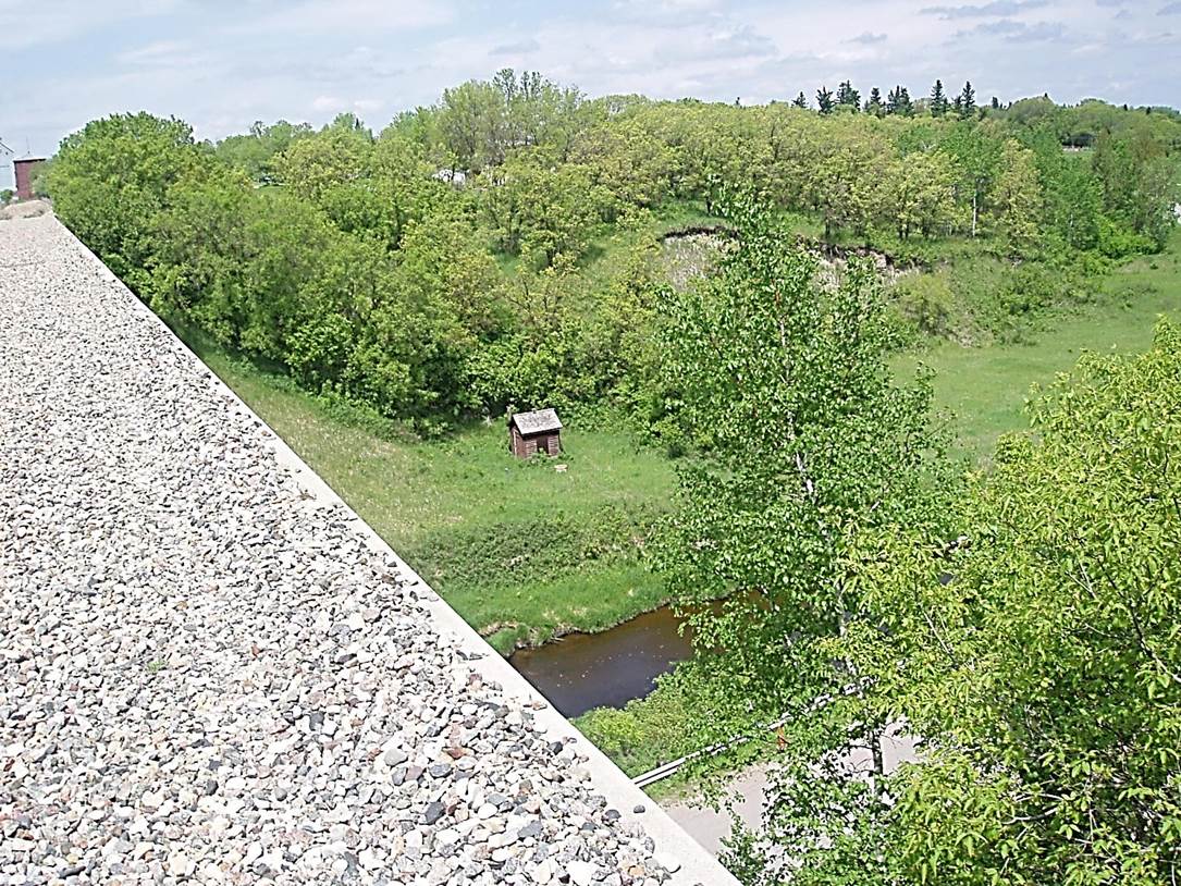
 2011/05, Former CPR/Napinka Sub. mile 21.1, N.W. view from ballasted bridge deck looking down at Long River and pump house supplying Manitoba’s only standing CPR wooden water tower (upper left along track bed). Notice access road (lower right) under bridge leading to the village of Clearwater (located in upper right of photo). (Click on photo for detail) © Text and Photos exclusive copyright of N. Froese.
Note
Respect of and Permission for Access to Rail Property: This publication consists of a series of photos of rail pictures from Morden, MB to Killarney, MB and focuses on the CPR, and the Boundary Trail Railway Co. Right of Ways. In no way should these photos encourage persons to trespass on these railway properties in order to take pictures unless they first contact and obtain and complete a “Release of Liability And Indemnity Agreement in Respect of Visiting” from the railway companies on who’s property they intend to visit. For further information about railway safety and protocol, visit the website – http://www.operationlifesaver.ca/wp-content/uploads/2012/01/PRsafetyguide_EN.pdf
